Preparing to Travel in El Salvador
This Friday, August 25th, I’m going to El Salvador! For the first time in my life.
From my current location in Antigua, Guatemala, it’s just a 3-4 hour shuttle van across the border and on to Santa Ana city in western El Salvador. The van will even take me directly to my hostel there. Easy, peasy.
Now I’m guessing that a lot of people who hear ‘El Salvador’ will more or less cringe, thinking it’s a very dangerous, risky country to visit.
And I have to admit that when I decided to finally explore Central America, even I had a few doubts about the safety of a few countries there, in particular, El Salvador, Honduras and Nicaragua (I felt confident that Costa Rica, Panama and Belize were safe destinations, but I wasn’t 100% about the other three). And my mother was terrified.
To set things straight, I began my research of the region.
My usual approach to preparing to visit any new country involves several steps of research. I love research. And I love trip planning. So I always set to it quite happily and excitedly.
Here’s what I generally do:
First, if at all possible, I head to a big bookstore to read through guidebooks on the country. I especially like Lonely Planet. But I also check any others that are available, for cross-checking purposes. Fodors’. Moon Handbooks. Footprint Guides.
Secondly, online I check out the travel blogs of fellow bloggers who I know have visited the country in question. After that, I do a more general internet search about travel to that country, just to see what else comes up.
So to get ready to visit El Salvador, I headed to a big bookstore not far from my mom’s house in St. Petersburg, Florida. Well! Lo and behold, ZERO guidebooks on El Salvador!
I guess I shouldn’t have been so surprised. I hardly think El Salvador is a prime travel destination for many Americans. Lol
I did at least find one or two more general guidebooks covering all of Central America. That was a start, but the problem with regional guidebooks is that they exclude a tremendous amount of detail and even entirely leave out many great off-track destinations in each country, as the book has only have enough room to cover the prime destinations.
So I headed back home to check out travel blogs. I knew that Dani & Jess of Globetrotter Girls had visited El Salvador. And I quickly found several other bloggers I know who had visited as well. Stephanie at Travel Chica, Alex in Wanderland, Nomadic Matt and A BritandaBlonde. I read all of their articles on El Salvador.
With the lack of an El Salvador guidebook, the stories, tips and information from these informative and fun travel blogs actually became the entire basis for my trip to the country. Thanks fellow bloggers! You’re awesome!
From them I learned about the Ruta de Flores (Route of Flowers) in western El Salvador, the country’s famous Pacific coast surfing beaches, the artsy cultural town of Suchitoto situated on the crater lake of the same name, El Imposible National Park and Alegre town, among other places.
I even discovered that the capital city, San Salvador, has several worthwhile attractions, including acclaimed museums and historic buildings. And apparently it’s not nearly as dangerous as it used to be.
All these travel bloggers (most female, btw) reported that they found El Salvador to be very friendly, beautiful, diverse and full of delicious foods. And, importantly, safe for travelers.
They all mentioned being aware that most people think El Salvador is dangerous, and that they themselves discovered first hand that the El Salvador of today is undeserving of that antiquated reputation. None of them had any problems, nor did they hear of any travelers having problems in El Salvador (Are you reading this mom?!)
Great, I was convinced. And excited to go explore El Salvador… Even if mom is still terrified. Bless her.
Here are links to the El Salvador sections of each of these blogs, where I learned all about the country myself:
Globetrotter Girls-El Salvador – posts on Ruta de Flores, Suchitoto, Alegria, food, specific hostels and costs
Travel Chica-El Salvador – posts on El Trunco Beach, Juayua town on Ruta de Flores, costs, safety and foods
A Brit & A Broad-El Salvador – general post about their El Salvador experience and a video
Nomadic Matt-El Salvador – basic guide with costs, food, etc and several recommended destinations
Alex in Wanderland – articles on El Tunco and El Cunco beaches
After reading about all the wonderful places to visit and making a tentative schedule, I realized with some surprise, that it will actually take me one full month to explore this tiny country – Central America’s smallest.
Here’s my tentative one month schedule:
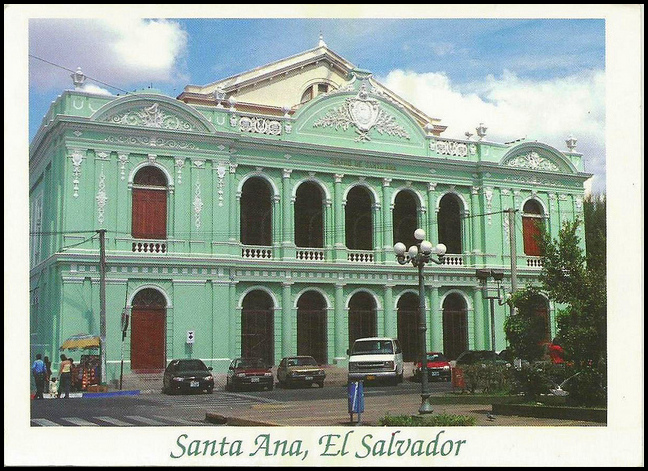
Santa Ana – El Salvador’s 2nd biggest city, located in the west just km from the Guatemalan border
2-3 days to explore historic buildings, get adjusted to El Salvador, use ATM etc
Lake Coatepeque – crater lake just south of Santa Ana
3-5 days to relax, enjoy the scenery, and compare it to Lake Atitalan
climb Volcanoes Santa Ana and San Marcelino in Cerro Verde National Park, near the Lake (If possible in rainy season)
Route of Flowers – loop through picturesque mountain villages with art, food festivals and nature
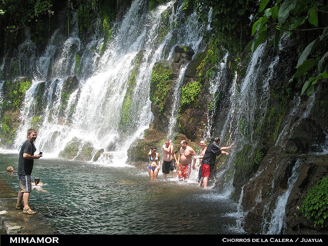
one week visiting towns, in particular Juayua, Apaneca, and Ataco
Tacuba – village at western edge of Ruta de Flores and access point for hiking El Imposible NP
2-3 days
Hike in El Imposible National Park – If it’s possible (lol) to hike during rainy season
1 or 2 days hiking
San Salvador – capital city with museums, parks and architecture
3-5 days
Suchitoto town on Lake Suchitoto – cultural & artistic heart of El Salvador, just one hour north of San Salvador
5-7 days
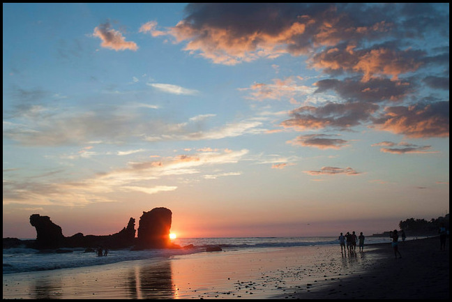
Pacific coast beaches – some of Central America’s most famous surfing beaches
7-10 days
Here are some useful factoids about El Salvador:
– El Salvador is located right in the middle of Central America, situated on the Pacific Coast side of the narrow Central American isthmus. It’s bordered on the west by Guatemala, on the north and east by Honduras, and on the south by the Pacific Ocean.
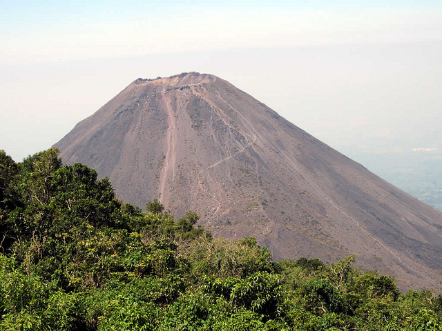
– El Salvador is a very mountainous country with many volcanoes, crater lakes, dense tropical jungles, mountain villages, historic Spanish towns and wild Pacific surfing beaches.
– It has a hot humid tropical climate year round, with a dry season from Nov to April and a rainy season from May to October. Daytime temperatures are between 28-31 C / 80-90 F, while night time temps are cooler at 15-20 C / 60-70 F.
– El Salvador is the smallest of Central America’s seven countries. It’s about the size of New Jersey, half the size of Switzerland. It’s shaped pretty much like Pennsylvania – a long rectangle stretching east to west.
– From west to east, the entire country stretches only 300 km / 186 miles and can be driven in 5 hours. North to south it’s only 130 km / 80 miles, but due to mountainous terrain and narrow winding roads, it takes about 3 hours to drive from the Pacific coast at La Libertad to the northern border with Guatemala at tiny border town of Citala.
– The currency is called ‘colon’. At the time of writing, $1 US = 8.75 colones. However, US dollars are generally used instead, with the colon rarely seen in circulation. In any event, $1US = 8.75 is a better exchange rate than for Guatemalan Quetzales, at $1 = 7 Q. Hopefully that means El Salvador will be even cheaper!
I’ll be writing my own accounts of these places in El Salvador as I go. So be sure to check back regularly to find out all about Central America’s tiniest nation.
You might also find the following articles useful:
My Itinerary Through Central America
My First Year of Travel in Latin America
Beach Hopping Along Mexico’s Central Pacific Coast
=================================================================






 Hi! I'm Lash, an American nomadic world traveler who's been traveling solo since 1998. I’m passionate about traveling the world nomadically and then sharing it all with you. I hope to inspire you to travel the world, to entertain you with tales from the road, and to help you reach your travel dreams. Welcome!