BALI TRAVEL TIPS: 5 Best Scenic Drives in Bali
Anyone who has visited Bali, Indonesia knows about the horrendous traffic conditions plaguing south Bali. The traffic-infested region includes the entire area from the airport south to Nusa Dua, west through the massive Kuta-Legian-Seminyak-Cangu sprawl, east past Sanur to Candidasa, and north through Denpasar city and Ubud.
Simply put, southern Bali is a total nightmare. Traffic jams, spewing exhaust fumes, and way too many vehicles for the roads mark the south Bali experience.
Thankfully, the rest of Bali has much lighter traffic! In fact, Bali has some downright empty roads, and incredibly scenic ones at that.
I’ve been visiting Bali, Indonesia regularly since 2000, staying 2-6 months each time. I’ve explored the entire island extensively by both bicycle and motorbike. Although I have not driven every single road in Bali, I have driven most of them.
Through my explorations I’ve discovered some incredibly gorgeous scenery on twisting mountain roads, along Bali’s extensive coastlines and through lush rice fields.
This year it crossed my mind to compile a list of Bali’s most scenic rural roads, with the hope that other independent, adventurous travelers will enjoy Bali’s astounding scenery too. I always encourage everyone to get out of southern Bali as quickly as possible and see the real Bali.
These routes are great either by bicycle or motorbike. They are 45-75 km long and take 2-3 hours to drive straight through by motorbike. By bicycle they take anywhere from 2-8 hours, but that varies greatly with each road and the cyclist’s pace and endurance.
You could certainly explore any of these roads at a more leisurely pace, stopping to admire views, architecture, temples and other cultural points of interest. Each route could easily take up a half day of explorations, even by motorbike.
The roads on this list had to ‘make the cut’. They must afford stunning views and also have light traffic.
Needless to say, I have completely eliminated all roads in south Bali.
I also left out southern Bali’s main east-west artery running between Java and Denpasar, Bali’s capital city. That road has some incredible scenery. But the heavy truck, bus, and motorbike traffic completely kills the drive experience. Besides deafening traffic, you can’t possibly enjoy any scenery when you have to concentrate double hard on roads to escape with your life.
Here are my favorite scenic roads in Bali:
——————————————————————————————————-
View Scenic Bali Drives – Singaraja to Kintamani in a larger map
1. Kintamani mountain road from Singaraja up to Kintamani / Mt Batur crater rim
Location: from Bali’s central north coast to central Bali’s Mt Batur volcano
Distance: 40 km
Drive time: 1.5-2 hours by motorbike, non-stop. Could easily take 3 hours or more to view sights.
By bicycle, best done in reverse, going mostly down hill from Mt Batur to Bali’s north coast. 2 hours
Description: This mountain road winds its way up Mt Batur through typical Balinese villages, past roadside temples, through clove plantations and through stone villages perched on a steep ridgeline with astounding views of surrounding ridges and to the far north coast of Bali.
This road starts 10 km east of Singaraja on Bali’s far north coast. It’s a large, clearly marked road with a sign to ‘Kintamani’.
This is probably my all-time favorite road to drive in Bali. The scenery is gorgeous and ever-changing. There’s almost no traffic. Clove orchards line the lower half of the road and add the pungent smell of fresh cloves in season. Near the top are amazing panoramic views of nearby steep ridges and all the way down to the north Bali coast.
The last few km, the road passes through a lovely pine forest, something quite rare in tropical Asia. At the top, the first village you reach is Penulisan, which is home to Bali’s highest temple: Puri Penulisan. There’s an entry fee for tourists.
Once you’re on top of the crater rim, it’s another 7 km to reach Kintamani market town and famous Kintamani Temple, lined by colorful stone statues. Superb views into the vast crater and Lake Batur are possible from several points along the crater rim road.
—————————————————————————————————————
View Bali Scenic Drives: Kintamani to Ubud on village roads in a larger map
2. Kintamani to Ubud via Manikliyu village road
Location: from Mt Batur’s crater rim in central Bali to Ubud in south central Bali
Distance: 40 km
Drive time: 1 hour by motorbike / 1.5 – 2 hours by bicycle downhill or 4-6 hours uphill from Ubud
Description: On Mt Batur’s southern flanks, it’s a straight shot down shallow-grade rural roads through rice fields and tiny villages. The road does bend through a few villages, but otherwise is dead straight downhill towards Bali’s southern coast. Near Ubud, the road turns east and plunges into a deep, narrow gorge and up the other side before continuing south through Payangan town and then turning east to Ubud.
Unlike the northern road from Singaraja up to Mt Batur, which winds crazily in hairpin turns, the roads on Mt Batur’s southern side are all straight, shallow grade roads.
To take this wonderfully empty country road from Kintamani, you must first locate the Manikliyu Road . Luckily, it is sign posted ‘Manikilyu’. From Kintamani market, the road is about 2 km north along the crater rim. Look for a very sharp turn on the crater rim’s outside. (not going into the crater)
Once you find the road, it’s a pretty clear shot all the way down to Payangan town. But you will have to make a few turns through little villages. If you’re unsure, just ask locals for ‘Ubud’ They’ll point you in the right direction. In any event, just keep going downhill on straight shallow-grade roads and you’ll be headed in the right direction.
About 3 km north (and west) of Payangan town, the road suddenly turns east (left) and plunges into a deep river gorge, across a small bridge, and steeply up the other side. You’ll reach a T junction. Turn south (right / downhill) and you’ll soon reach Payangan market town.
From there, the lovely empty roads are finished. You’ll be driving in traffic the remaining 10 km into Ubud. Continue south from Payangan for 6 km, where you’ll see a sign for ‘Blanco Museum’ and Ubud to the left / east. Turn east/ left and follow that winding road the remaining 5 km into central Ubud.
* Be sure not to take the main roads from Mt Batur crater down to Ubud because they are packed with heavy traffic.
———————————————————————————————————-
View Bali Scenic Drive: Amlapura to Amed in a larger map
3. Coastal road from Amlapura to Amed
Location: far east Bali.
Distance: 45 km.
Drive time: 2 hours by motorbike. 4-6 hours by bicycle (seriously).
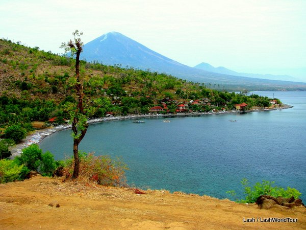
Description: A gorgeous, remote coastal road that twists, turns, climbs, and falls around the eastern side of Mt. Seraya on the far eastern shores of Bali island. Ascents and descents are incredibly steep.
The road is narrow and in variable states of disrepair, though it is paved the entire way. It passes through pretty forests, primitive mountain villages, and dry scrubby hills as it winds its way around the coast. It offers continually changing, dramatic views of the Bali Sea.
The silence and undisturbed sounds of nature in that region are phenomenal. You can best appreciate that by bicycle. Sadly, motorbike engines will drown out the wonderful natural symphony. If you drive a motorbike along this route, be sure to stop a few times and turn off the engine to listen!
Here’s what you’ll be treated to: the distant ocean roaring far below, wind rustling through trees, outrageous roosters screeching, dogs barking obnoxiously, snorting pigs, children laughing and screaming, peoples’ yelling voices muffled by the all-invasive nature. Interspersed by silence.
You can make a full loop back to Amlapura on a beautiful lushly forested inland mountain road. Some of Bali’s most stunning terraced rice fields are nestled along that road. It’s another 20 km from Amed back to Amlapura along this road. (see route 4)
———————————————————————————————————————
View Scenic Bali Drives – Amed to Rendang in a larger map
4. Amed to Rendang (central Bali)
Location: eastern Bali, along the southern flanks of Mt. Agung
Distance: 40 km
Drive time: about 1.5 hours by motorbike non-stop / about 3-4 hours by bicycle
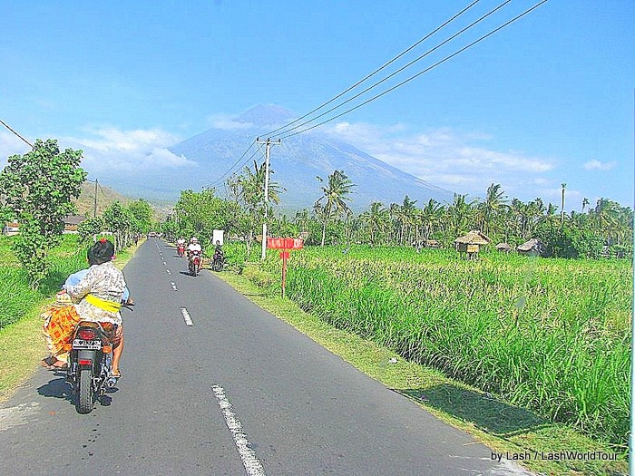
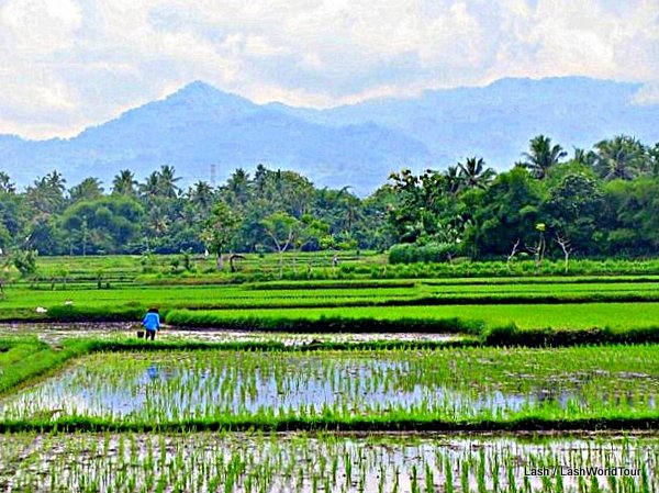
Description: This charming road heads inland from Amed, passing gorgeous terraced rice fields and climbing up over a small mountain en route to Amlapura city. Just north of Tirtanganga (and Amlapura city), a smaller road turns westward and passes through many tiny villages and fields as it moves west along the southern flanks of Mt Agung along mostly flat roads to Sibetan.
From Sibetan, the road climbs up over another mountain through dense forest and down to Selat village. Continuing west, the road plunges through several deep ravines lined with steeply terraced river fields and marked by gushing rivers in the bottom of the gorges. The road pulls out of the final gorge valley, a white-water rafting spot, and finally reaches Rendang town.
From there, the road south to Klungkung city becomes increasingly more heavily trafficked. But until that point, the deep gorges, cool winding mountains and flat country roads are well worth a drive.
—————————————————————————————————————–
View Scenic Bali Drives: Seririt to Gilimanuk in a larger map
5. Siririt City to Pemuteran to Gilimanuk
Location: Bali’s north coast, westward
Distance: 71 km = Siririt to Pemuteran 35 km / Pemuteran to Gilimanuk 36 km
Drive time: 2 – 2.5 hours by motorbike / about 3 – 4 hours by bicycle
Description: From Siririt City west to Pemuteran this tranquil, flat road follows Bali’s north coast along sweeping flat rice fields backed inland by Bali Barat Mountains. You have it all- sea, fields and mountains. The region is mainly rural, passing through a few small villages along the way.
Just west of Pemuteran, the road turns inland and southward, where it soon climbs up through Bali Barat National Park. This entire section of road passes through forested mountains with no villages in sight.
Sights: flat rice fields, Bali Sea, Bali Barat mountains, grape growing region, seaside temples at Penulisan, Bali Barat National Park forest, beach and coral reefs at Pemuteran.
Places to stop and visit: seaside temples at Penulisan, beach and coral reefs at Pemuteran
—————————————————————————————————————————————
* Please note that you’ll need a good map of Bali to navigate most of these routes. My Google custom maps in this post are just general direction markers. Usually the maps in guidebooks are detailed enough.
—————————————————————————————————————————————

 Interested in being guided around Bali by an expert of the island?
Come join me on my 2-week small group tour of Bali in June, 2014. Four to ten guests will accompany me on a fun culture and nature immersion tour of the Island of Gods: Bali Nature & Cultural Tour
Did you know I wrote a guidebook to touring Bali by bicycle?
If this sounds like fun to you, check out my guidebook:
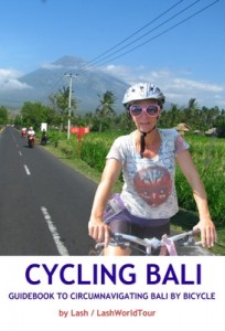
Cycling Bali: Guidebook to Circumnavigating Bali by Bicycle by Lash/ LashWorldTour
The Cycling Bali guidebook explains everything you need to travel around Bali by bicycle.
It starts with a thorough introduction to Bali island, arrivals, and all the basics for travelers to ‘Island of Gods’.
The guide then focuses on cycling, detailing Bali’s road, weather, topography and cycling conditions plus a detailed explanation of preparing to cycle-travel, including training, what to take cycling, tool kits and parts, bike maintenance, and even how to take your bike on an airplane. READ MORE
buy print version check here for pdf and eBook versions
————————————————————————————————————————————————-







 Hi! I'm Lash, an American nomadic world traveler who's been traveling solo since 1998. I’m passionate about traveling the world nomadically and then sharing it all with you. I hope to inspire you to travel the world, to entertain you with tales from the road, and to help you reach your travel dreams. Welcome!



35 pings
Skip to comment form ↓
Renting a Scooter & Touring Bali, Indonesia | The Drinking Traveller
2014/09/27 at 4:23 pm (UTC 8) Link to this comment
[…] rode up, past Pura Ulun Danu Bratan to Lovina, then borrowed a couple of scenic rides from Lash, who knows Bali ridiculously well, and drove the mountain road up to Kintamani, along the crater […]