12 Interesting Facts about Chile
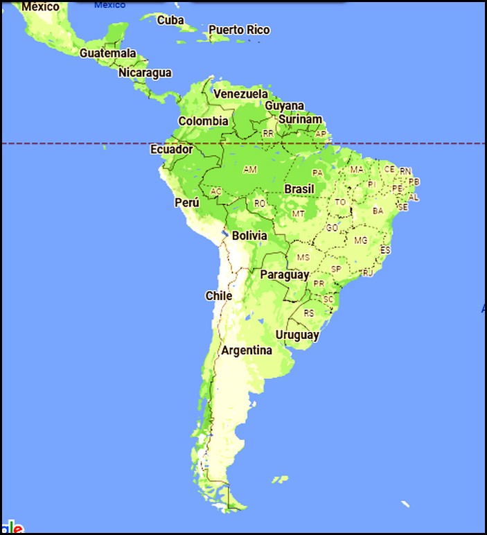
Most people know that Chile is located in South America. And many may also know that it’s situated on the lower western side of the continent with a Pacific Coast and that the Andes Mountains run through the country.
Some outdoor enthusiasts and nature lovers may further know several famous natural places in Chile, such as Torres del Paine, Patagonia or the dry Atacama Desert.
Beyond that, I’m guessing that most people don’t know many details about Chile’s iconic places, incredible natural diversity and superlative boasting points. I certainly didn’t know them until recently, when I started researching Chile in preparation for my three-month visit.
Now that I’m here, I’ve learned many other interesting things about the capital city, Santiago, and the country in general. I arrived in Chile less than three weeks ago and thus far have only spent time in Santiago and the pretty coastal city of Valporaiso. Both cities are very enjoyable, with many stunning buildings and things to see & do.
As I continue researching about the most beautiful places to visit in Chile, its complex history and the most interesting things to see & do throughout the country, I’ve learned a many amazing things.
Following are 15 most amazing things I’ve learned about Chile to date…
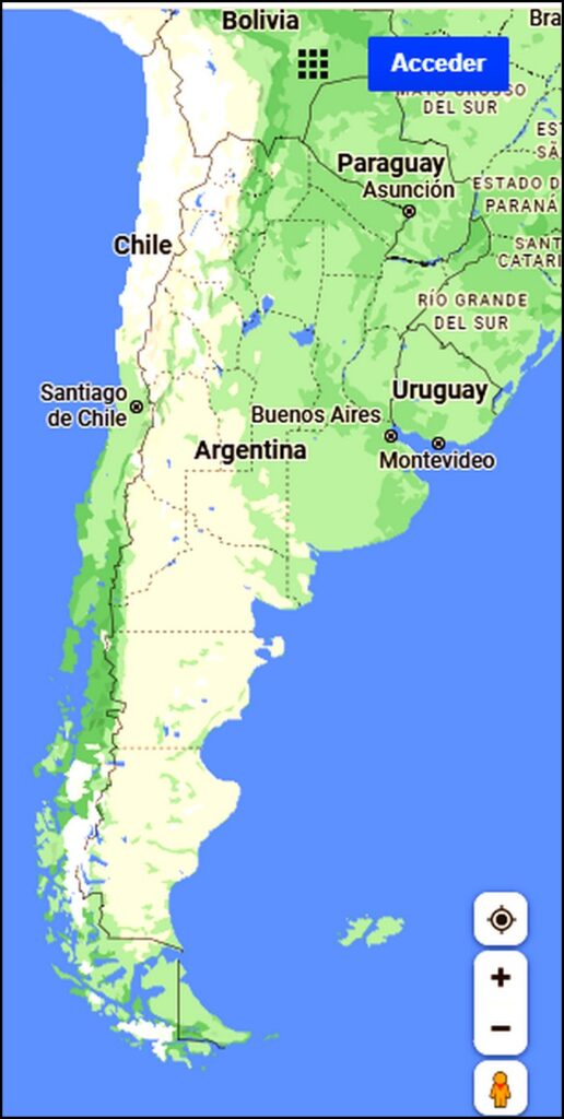
1. Chile has 6435 km / 4000 miles of Pacific coastline
Chile has one of the world’s most unusual country shapes. It’s extremely long and narrow. One Chilean man I met recently described Chile as having the shape of a piece of bacon! Well, actually, that’s about right.
The country is only 110 miles / 177 km across from east to west, on average. But from north to south, Chile spans 2653 miles / 4270 km. That’s close to the distance across the USA from west to east, which is a total of 3000 miles.
More specifically, the country of Chile runs from latitude 17 South all the way down to latitude 56 South, getting pretty close to the Antarctic circle.
The total length of Chile’s coastline is even longer. It totals 4000 miles / 6435 kms. To give some reference, the US Atlantic Coast is 2069 miles long, making Chile’s coastline almost double.
2. South America’s tallest buildings is in Santiago
Opened in 2014, the Gran Torre (Grand Tower) in Santiago rises 300 M / 984 ft straight up into the air, making it the tallest skyscraper in South America. It has 62 floors and 24 elevators, including several ultra-fast express elevators.
The sleek silvery glass Gran Torre is connected to the massive Costanera Center Complex, which has a huge six-floor shopping mall, two luxury hotels and two office towers.

3. South America’s 4th largest subway system is in Santiago
Santiago’s extensive Metro system includes seven long interconnected lines with a total of 136 stations and 86 miles / 140 km of tracks. It is clean, efficient and relatively-inexpensive, with very frequent trains running from early morning until late at night.
More than two million passengers per day, on average, use the Metro. So it is generally fairly crowded throughout the day, but crushingly-jam-packed during morning and evening rush hours.
Each trip costs under $1 US, with a single ticket good for multiple subway cars and buses going in a single direction for two hours.
4. One of the driest places on Earth is in Chile
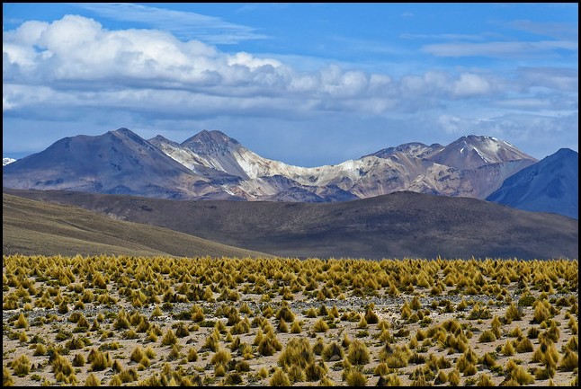
Situated in Chile’s far north, close to the borders with Bolivia and Peru, lies the incredibly dry and vast Atacama Desert, set on a high arid plateau. It’s so dry that the average annual rainfall is only 0.6 inches… In an entire year!
Sometimes it doesn’t rain at all in parts of the Atacama Desert for up to four years in a row. And there’s one area where it never rains. Ever. There are also dry riverbeds that scientists estimate have been dry for over 120,000 years!
This vast area of 49,000 square miles is surprisingly diverse in topography and geographical features. There are hills, mountains, rocky regions, sandy desert areas, oasis, salt lakes and other unusual areas.
Perhaps most amazingly, there’s a lot of specialized natural vegetation thriving in the Atacama Desert. More than 500 plant species have been identified there.
One of the most famous & unusual places in the Atacama Desert greatly resembles Mars. In fact, a lot of research, tests and practices for space missions are done in the Atacama Desert by various space programs.
It’s a region of great natural beauty and diversity and, thus, one of Chile’s most famous tourist attractions.

5. The real Robinson Crusoe Island is in Chile
Robinson Crusoe Island is part of Chile’s San Fernandez Islands, located 670 km off the coast of Chile. It was there that Scottish sailor Alexander Selkirk was marooned alone for four years, from 1704-1708.
His real-life adventure was the base of author Daniel Dafoe’s namesake book, which was published in 1719, just one decade after the world-famous island escapade.
The small island had other names throughout history, but was re-named Robinson Crusoe Island by the Chilean government in modern times to attract tourists. It’s a mountainous, verdant island with a subtropical climate. As a result, Selkirk was able to survive by fishing, hunting, food gathering and building shelter for himself.
Selkirk was part of a British sailing fleet and a very experienced sailor. He had been gravely concerned about the seaworthiness of his ship, insisting that it be repaired when they stopped at the uninhabited San Fernandez Islands to re-supply with water.
Selkirk declared that he preferred to be left on the island than to continue sailing in the open Pacific on such an unsafe ship. So he was left behind with just his clothes, bible, gun, gun powder and tools. He survived alone for four years before finally being rescued by a ship who specifically went back to find him.
Meanwhile, Selkirk had been correct about the ship’s danger. It sank less than one month after he was marooned. Most onboard drowned.

6. Easter Island is within Chilean territory
The unique, world-renowned Easter Island is also part of Chile. This island is located a whopping 3600 km / 2337 miles from Chile, out in the middle of the vast Pacific Ocean.
It’s so far away that it’s closer to the French Polynesian Islands, where it has the name Rapa Nui. In Spanish the island is called Isla Pascua (Easter Island).
Nowadays it’s inhabited by a small population of about 2800 people. Besides its ultra-famous stone statues, the beautiful mountainous island has crater lakes, rivers, waterfalls, lush vegetation and rugged coastlines.

7. Chile has 620 volcanoes
Chile is famous for its high Andes Mountains. But fewer people know that those mountains include hundreds and hundreds of volcanoes. In fact, about half of Chile’s total land area is volcanic in origin.
Dozens of these volcanoes are still active today. In the 1900s there were nearly 60 volcanic eruptions in Chile.

8. Chile is extremely prone to Earthquakes
Chile’s earthquake vulnerability is due to the country’s location on top of two major tectonic plates. the Nazca Plate and the Continental Plate of South America.
The offshore, sub-Pacific Nazca Plate is slowly sliding eastward under the Continental Plate, causing all the disturbances.
In the 1900s Chile experienced 28 major Earthquakes registering over 6.9 on the Richter Scale. One of the most notable was a 1960 quake registering at 9.50. It caused a massive tsunami that completely destroyed several fishing villages and actually changed the topography of Chile’s coastline in the region.
Another very notable Earthquake hit Santiago in 2010, destroying many major buildings in the city.
Not surprisingly, all Chilean children are taught Earthquake safety protocol and given regular drills for Earthquake preparedness. Buildings are designed and constructed with Earthquakes in mind, much like in Japan.

9. Chile has incredibly diverse natural habitats
As you might have realized by now, Chile is a country with incredible natural diversity. In fact, Chile’s natural diversity is so extensive that most of the Earth’s climates and vegetation zones are found somewhere in the country.
That’s due to several geographical factors, including its high Andes Mountains, its volcanic origins, its location beside the Pacific Ocean and the country’s great differences in latitudes.
As noted above, Chile stretches north to south from latitude 17 S to 56 south. That alone accounts for much of the great differences in temperatures found throughout the country. The far south is so cold and so close to Antartica that the mountainous mainland and offshore islands are filled with glaciers, snow fields and deep fjords. While far northern Chile is close enough to the equator to have a year-round mild, even climate.
Huge differences in altitudes provide other reasons. Coastal strips and some interior valleys are set at/near sea level, while Andes Mountains within Chile soar up to over 22,000 ft / 6870 M.
All told, Chile has the ultra-dry Atacama Desert, geothermal areas, salt lakes, sandy beaches, coastal cliffs, rough surfing waters, fertile valleys, hundreds of volcanoes, some of the world’s highest mountains, deep fjords, glaciers, snow fields, old-growth forests, rain forests, waterfalls, rivers, lakes, regions with Mediterranean climate and one of the rainiest places on the planet.
In short, just about every climate and natural geographical feature is found somewhere in Chile.

10. Chile is home to the world’s southernmost city – Puerto Williams
Located at latitude 54° 56′ south, Puerto Williams is the southernmost city in the entire world. With a population of less than 3000, it’s really more of a town than a city. In fact, it’s a small town filled with a mix of Chilean navy personnel, civilians, fishermen and scientists.
Due to its close proximity to Antarctica, Puerto Williams makes a great base for scientists studying Antarctica and for tourists visiting Antarctica, Cape Horn or nearby Chilean islands and national parks.
Just across the Chilean border to the north is the larger Argentinian town of Ushuaia. It’s also used as a base for tourists and scientists to Antarctica. Being situated just slightly north of Puerto Williams gives Chile’s town, Puerto Williams the edge on its aclaimed world title.

11. Chile also boasts the world’s southernmost national park
Parque Cabo De Horno National Park lays claim to the world’s southernmost national park. It’s also the southernmost region of Chile.
The park was created in 1945 and includes islands of three adjacent archipelagos: Cape Horn Islands, Hermite Islands and Wollaston Islands.
In 2005 UNESCO designated the islands as a World Biosphere Reserve, in conjunction with nearby Parque Nacional Alberto de Agustino.
The islands of the park are mostly fairly low-lying, with a couple mountain peaks reaching up to around 2000 ft. They are treeless with low vegetation covering many areas. Various maritime birds call the islands home, including the Magellan Penquins.
Not surprisingly, the islands are cold, with an annual average temperature of only 5.2 C / 41.4 F. This region is also generally cloudy, rainy and extremely windy/ Wind squalls reach up to 100 kph / 62 mph and gale-force winds blast the area 30% of the time.
In short, it’s an area that’s not especially pleasant or conducive to enjoyable human life.

12. The world’s closest land point to Antarctica is in Chile
It’s probably clear by now that the closest South American land to Antartica is in Chile. More specifically, it’s the aforementioned islands of Cape Horn National Park, Hermite Islands and Wollaston Islands archipelagos.
These islands are also the closest point to Antarctica in the whole world.

Summary
As you can see, Chile has a huge diversity of amazing natural places. It’s a very long, long country, so distances between various regions are quite far. Visitors to Chile may have to pick and choose the places most interesting to them or else have a few months to explore the entire country.
I have a three-month visa to explore Chile. Now that I know about all the incredible places, I hope I can visit most of them during my explorations.
I’ll be writing and sharing photos as I travel around this beautiful country. So stay tuned on FB and LashWorldTour.
============================
You might also enjoy:
13 Things I Love about South America
12 Surprising Facts about the Galapagos Islands
12 Interesting Facts about Peru
===========================






 Hi! I'm Lash, an American nomadic world traveler who's been traveling solo since 1998. I’m passionate about traveling the world nomadically and then sharing it all with you. I hope to inspire you to travel the world, to entertain you with tales from the road, and to help you reach your travel dreams. Welcome!



4 pings
Introduction to Valporaiso - Chile - LashWorldTour
2022/11/10 at 6:44 am (UTC 8) Link to this comment
[…] « 12 Interesting Facts about Chile […]
The 10 Most Spectacular Natural Places in Chile - LashWorldTour
2022/11/29 at 3:42 am (UTC 8) Link to this comment
[…] 12 Interesting Facts about Chile […]
Introduction to Uruguay - LashWorldTour
2023/03/23 at 10:54 pm (UTC 8) Link to this comment
[…] 12 Interesting Facts about Chile […]
9 Things Distinctly Argentinian - LashWorldTour
2023/04/13 at 6:23 am (UTC 8) Link to this comment
[…] 12 Interesting Facts about Chile […]